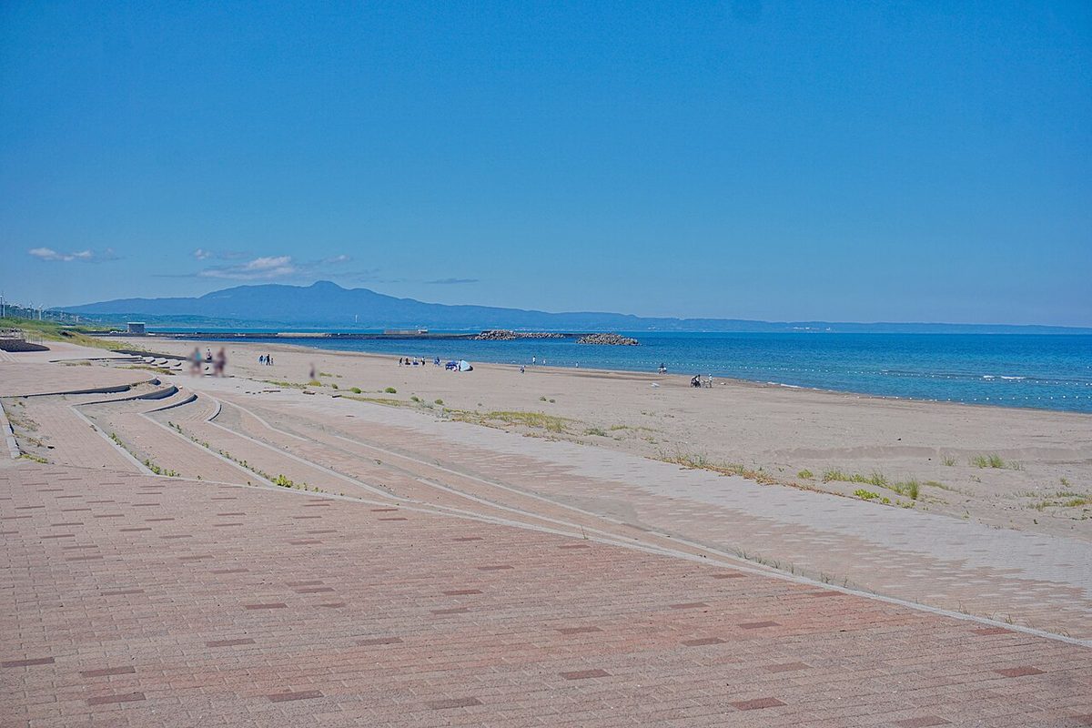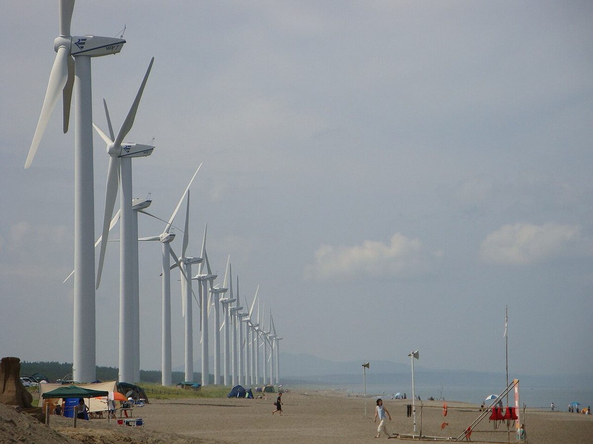
Kamayahama Beach
釜谷浜海水浴場
Mitane, AkitaBeauty ★★★★★
Odanohama Beach (小田の浜海水浴場) is a bathing beach in Kesennuma, Miyagi, in Japan's Tohoku region. In 2006 it was chosen by the Ministry of the Environment as one of the 100 Best Bathing Beaches in Japan — and named a Special selection (sea) out of only twelve beaches nationwide. The ministry's judges gave it the full five stars for cleanliness, calm.
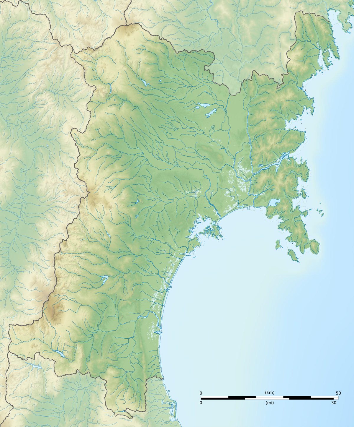
| Location | Kesennuma, Miyagi (気仙沼市、宮城県) |
|---|---|
| Region | Tohoku |
| Official selection | 100 Best Bathing Beaches in Japan — Ministry of the Environment, 2006 |
| Award | Special selection (sea) |
| Coordinates | 38.86167, 141.62889 |
| Beauty | ★★★★☆ 4/5 |
| Cleanliness | ★★★★★ 5/5 |
| Calm | ★★★★★ 5/5 |
| Gentleness | ★★★☆☆ 3/5 |
| Richness | ★★★★☆ 4/5 |
The ministry scored every beach from one to five stars on five points of view: beauty, cleanliness, calm, gentleness (safety and facilities) and richness (nature and local life).
There is a nationally rare beach of thundering sand, "Swim beach" in the vicinity. This is a beach about 200 meters long and 30 meters wide, with more than 90 percent purity of crystal and the strange sound of "C" and "C" and "C." But from here, we can use more than enough of the lissian beach's chrysalis and the magnificent Panorama map, and we can impress visitors without exception. On Oshima, you can cross by a passenger ship car ferry, but if you release the shrimpns to a group of strays that are chasing you, you can get a good catch in the air, and you can enjoy directly feeding them. There's a facility on the island called "The Experienced Museum of the Island" and an expert instructor who conducts experience studies such as "The Botanical Plankton Observation" and "The Design of the Sea Paper and Shell
ories." In addition to this, the island's experience library and local view of HikariX are frequently provided with various variety menus on the island by the Association. You'll be able to see how they're made, how they're made, how they're made, how they're made, how they're made, how they're made, how they're made, how they're living in the sea, how they're doing, how they're growing, how they're doing. It's in the Oshima, called the green pearl in the Gulf of Kesennuma, in Inland Coast National Park. On the other side of the sea, a large and small-spectral island is known as a calm, safe, shallow beach bath, blocking the waves. You can go to Oshima in a small boat and enjoy exploring the uninhabited islands, playing with them, and fishing. In his book Exploration of the Golden Island, Isagna Sebastian Bisquino, who visited the harbor at the command of the ISI, named this island "Santa Catalina Island." It has been reported that the "Oshima Corporation" on the side of Mt. Fuji is held over 1,000 years ago and is the most important protracted pleasure center in China. Large cleaning: Local view Hikari Association, community, middle school, and cleaning cars per year. A little cleaning: twice a day, guards conducted garbage pickings, and they set up the NPO law. One has begun working on creating an empty can-resident system. Also, he has been experimenting with fertilizers, and waste oil is currently running in pairs as biodile fuel, as well as fertilizing the flowers in the land and the landscape. We've had good results, and eventually we're trying to make it as fuel for passenger ships, fishing boats, buses and taxis. I can't do it. If you're on a railroad bus, you're on a bus. Trains are JRKesennuma. If you're in the car, you're in the car
Oshima is an island of 8.50 square kilometers, situated on the tri-land coast of Tohoku in Japan. The inhabited island belongs to Miyagi. It is usually called "Oshima," but if it is distinguished from other "Oshimas" throughout the country, it is called "Kesennuma." By June 2026, about a thousand families live on the largest island in the Miyagi and the Tohoku region. = Geographic = = Oshima is on the opposite bank of Kesennuma City. It's on the third-land coast, one of the characteristic real- life beaches, at the entrance to Bay. The mainland is separated by Oshima Seto and is only 230 meters away in the smallest place. With the island at the entrance to Kesennuma Bay, the bay is always calm, and because fishing port is a natural port, it is also called "Kesennuma" In the middle of March of 2011, however, in the middle of the Tokyo earthquake, tsunamis were large, and the island and Kesennuma City were severely damaged. There are several deserted islands and reefs around the island, such as Oshima, Oshima, and Iwazaki. The highest point on the island is in the north of the island, on the mainland against the mainland. At the top of Mt. Fuji there are few rare "green cherry" flowers. It's also an island where nature is rich, such as the thundering sand beaches. I was called "Oshima, be the pearl of green forever," by the writer's waterlessness. The northern part of Oshima is a region centered around Mount Tsunami, and there are colonies along the sea. The northern island of Manchuria is called Oshima Seto, where oysters and other fish are raised. The beach on the south west coast of Mt. Fuji once had regular ships arriving as entrances to the sea, but after the opening of the Oshima Bridge, there is a land entrance, and a large welcome terminal is set up as an active Hikari base. The area from the coast of Koura to the east of Tanaka's beach is the narrowest in the east and the lowest in the east. During the Tokyo earthquake, tsunamis crossed this part of the island temporarily. In the south of Oshima, along the prefecture road that runs south through the center of the island, south of the island, there is a town that forms the center of the island. On the east side of the Pacific Ocean is Odanohama Beach. On the southern tip of Diongosaki, with Iwazaki on the other side of Iwazaki, there is a lighthouse that forms the entrance to Kesennuma Bay. = History = = In the mid-Edo period's "Ekichi Shikichi" book, Oshima was originally called the Pharmaceutical Island. In modern times the whole island was made up of Oshima Island. In 1953 the Towns of Fowl, Matsukashi Village, combined with Kesennuma City, and in 1955, Oshima was organized into Kesennuma City, along with the New Moon Village. In the East Japan earthquake of March 11, 2011, when seaside lowland flooded, as well as tsunamis across the coast of Tanaka and Osama, and the island was cut off to the north and south. Although Oshima was isolated because of the tsunami that destroyed the coast port of the coast in the front door and the tsunami, there was support from the American Marine Corps's 31st Marine expedition, which landed on land from the airships and the airship Essex. Also affected were the lifts that tied up the beaches of Po and the mountains of Tsunami, and then were removed. = Traffic = = = Street = = The island is covered by a Oshima Bridge, passing through Kesennuma City. == sync, corrected by elderman == @elder_man From the experience of the Tokyo earthquake, the island was temporarily isolated, and on April 7, 2019, the bridge of the Oshima Bridge between and Oshima was built. Fukuoka Oshima Line itself was devastated by the earthquake and concerned about the delay, but the approach road was made higher than the tsunami's height, and was reassembled. On January 27, 2012. The bridge has been built successfully by the largest crane in Japan, the building of the Harada Salvazi. In NHK's popular documentary "Protestant Work Style," the giant cranes, with their eyes fixed on the engineers, were broadcast throughout the country. In addition, during the earthquake, the Crane ship, Kesennuma, rushed to the port of to work on recovery. == sync, corrected by elderman == == sync, corrected by elderman == More than 2021, the Sendai of Myyacobus, some of the Kesennuma rays, are arriving on the island at a limited time during the summer and fall season, and are arriving at the beach's Great Welcome Terminal. The details are to refer to the local section articles. == sync, corrected by elderman == There's a rail bus running by Myyacobus. Oshima Line Set up the main stop. The bold is a stop on the island. New King's Hall - Before Oshima's entrance to Oshima - At the Cove of Mt. (Sundays 8 - 4) In 1953, the Sendhoku Railroad opened as a seasonal route only for summer months. In the year 1962 (Miyagi; 1970, Miyagi; 1970, traffic, 1998.) There's a Kesennuma firm on the beach in Oshima. The beginning of the business was the coast of the Oura - which was in the shallows of the sea but later formed a line around the island. In 2005 there was a motion of decontamination, where Kesennuma City was to continue on the line with a grant. With the opening of the Kesennuma Oshima Bridge, the Oshima Line has been extended from April 8th 2019 to. == sync, corrected by elderman == Oshima, taxi 50. And I'm going to show you how this works. == sync, corrected by elderman == (ZQQQ 456X Bridge Port, Eye Hustice port) - The ferry and passenger ships were in service between the coast ports of Oshima, but, along with the opening of the Z Oshima Bridge, the train ended and abandoned its course on April 7, 1920. == sync, corrected by elderman == Since 1970, 12 passengers have carried emergency cases during the night when the Oshima train didn't operate. In the Tohoku earthquake, the island people were taken free of charge for about eight months after the earthquake. The ship's ship is stored on the island after the bridge has been completed. [Thrun] So let's see. Many sections of the island are designated as Thirdland Rehabilitation National Park. Akiyama: 235 meters. At the top of the mountain there are Resthouses, exhibitions and so on. It's chosen for the 100th prize, and you can enjoy the 360 degree panoramic view of the entire island and the Kesennuma bay, as well as the flowers of the swallow. There was a market ropeway, which opened in 1967, near the coast of Po and Lesthouse, which ran in season, but it was canceled from the east Japan earthquake in 2011. However, because of being classified as a Hikari facility, it was not subject to a nation's resuscitation venture, and there were circumstances of decommissioning equipment and decalization since before the earthquake. In September 2021, it was made clear that we were considering the installation of a year-old transportation facility to connect the parking lot at the bottom and in the middle. This is due to the complaint that, in spite of being an eye-opened spot, since the end of the turtle drift, there will be limited access and difficult access. A monorail maintenance program was announced since 2022 and opened in July 2026. The bellows of the beach: the first academically recognized beach of the rock sand in Japan. Japan's choice of Japanese rice is a success. The country's natural monument. Because the environment doesn't have much maintenance around it, it doesn't have cars and it's about 20 minutes away from the playwalk. It's a quiet beach far from the roar.
Beach profile and access notes: Ministry of the Environment, “100 Best Bathing Beaches” official pages (2006 selection), translated from the Japanese.
Article: translated from “大島 (宮城県気仙沼市)”, Japanese Wikipedia (CC BY-SA 4.0).
Photograph: Wikimedia Commons, as credited under the photo.